
[ad_1]
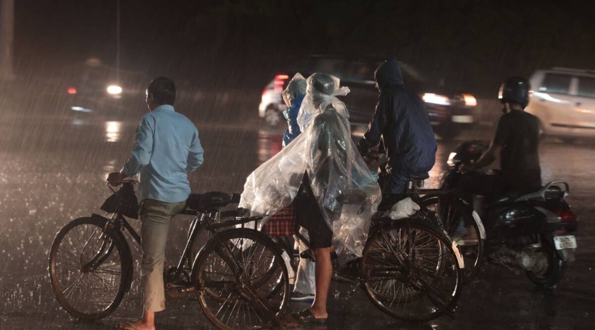
In what was the third consecutive day of persistent rainfall over Delhi-NCR, most parts of the city recorded moderate rain.
The Safdarjung weather station, the city’s base station, recorded around 10 mm of rainfall between 8.30 am and 5.30 pm. Palam recorded a higher amount of 21.9 mm and Aya Nagar recorded 17.4 mm.
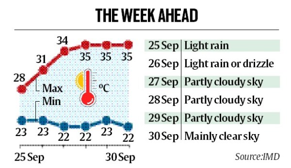
The intensity of rainfall is likely to reduce on Sunday when light rainfall is likely along with thundershowers in a few places. The intensity is set to reduce further on Monday when only very light rainfall is expected, according to the India Meteorological Department (IMD). Dry weather is set to return to Delhi from Sept ember27 to 30.
An IMD update issued on Saturday said that intense spell of rainfall that would continue over the plains of northwest India on Saturday and Himachal Pradesh and Uttarakhand over the weekend would reduce significantly thereafter. A cyclonic circulation, which is one of the weather systems contributing to the prolonged rainfall spell over northwest India, lay over northeast Rajasthan as of Saturday evening. The cyclonic circulation is likely to persist till Sunday, according to the IMD. A western disturbance has also been affecting parts of Northwest India.
Till 8.30 am on Saturday, the Safdarjung weather station recorded 145.9 mm of rainfall for September, which is an excess of 25% against the normal of 116.8 mm. The Palam weather station has recorded a larger excess of 68% for the month, having received 170.9 mm of rainfall against a normal of 101.8 mm. However, rainfall for the monsoon season so far still remains at a deficit of around 21% at the Safdarjung weather station.
On account of overcast skies and rainfall, the maximum temperature has remained below 30 degrees for three days. The maximum temperature recorded on Saturday was 27.2 degrees Celsius, seven degrees below the normal.
[ad_2]
Source link